Queyrettes Pass
A high-altitude passage through the Sancy massif, Queyrettes Pass crosses the landscapes of Auvergne's high moorlands, between volcanic peaks and pastoral traditions. Ideal for hiking and cycling.
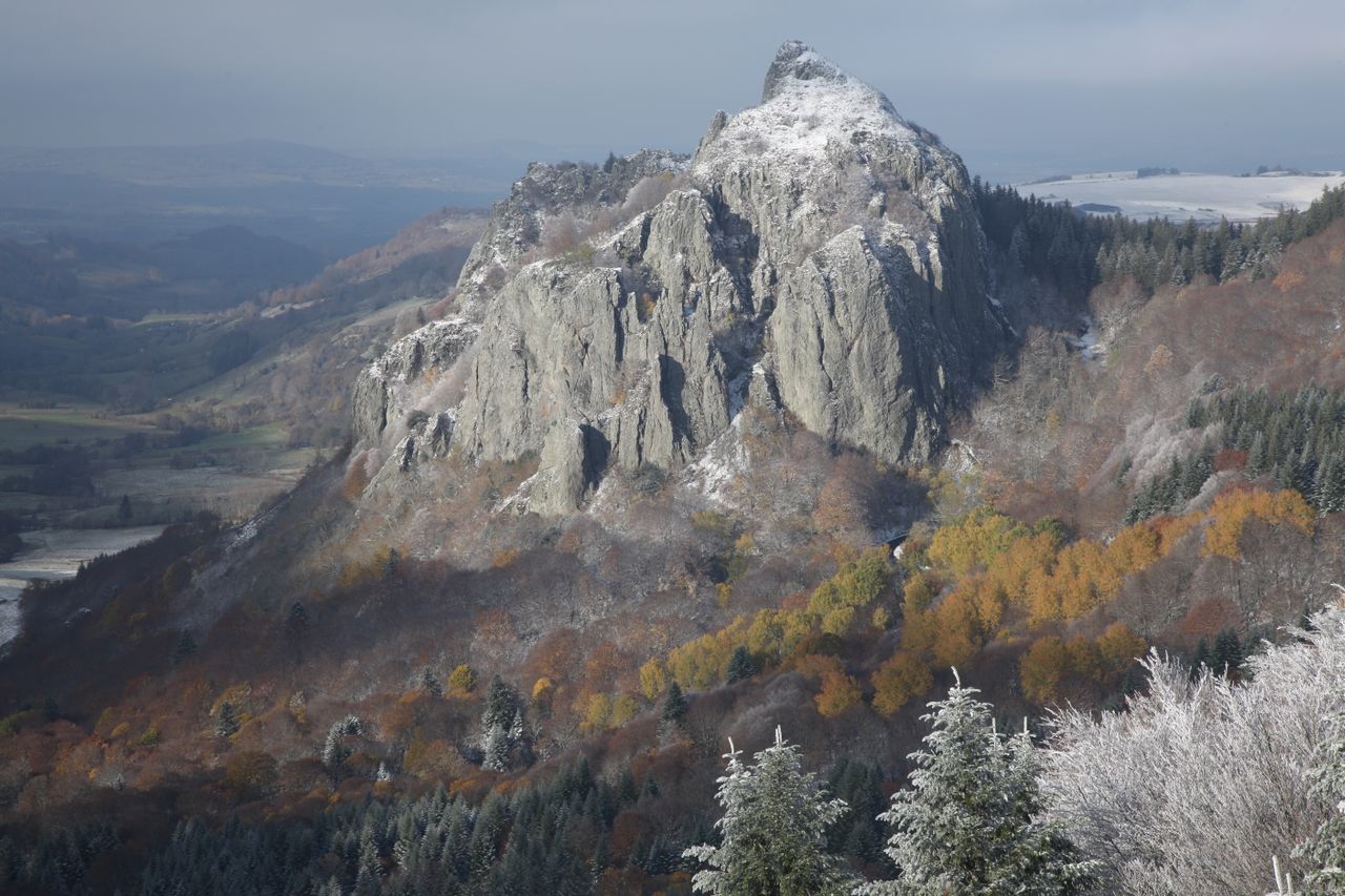
Queyrettes Pass is a high-altitude passage located in the Sancy massif, in Auvergne (Puy-de-Dôme). It connects the slopes of the volcanic massif and serves as an appreciated waypoint for hikers and cyclists. The landscape here is typical of Auvergne's high moorlands: open meadows, silhouettes of volcanic peaks on the horizon, an atmosphere of well-preserved mid-mountain terrain.
What to see
From the pass, the eye sweeps across the rounded reliefs characteristic of Auvergne's volcanism. The surrounding slopes are covered with alpine grasslands and blueberry moorlands. On clear days, the Sancy summits and neighbouring peaks stand out sharply. Local wildlife—raptors, pipits, sometimes chamois—regularly animate the landscape.
History and context
Like most Sancy passes, Queyrettes long served as a transhumance route between summer pastures. Herds of Salers and Aubrac cattle used these seasonal passages to reach the high-altitude grazing lands. This pastoral tradition remains visible in the architecture of burons scattered across the slopes.
Highlights of a visit
Ridge hiking
The pass fits naturally into hiking loops connecting the massif's summits. Marked trails allow you to reach the surrounding heights without major technical difficulty, offering sweeping views across the chain of volcanic peaks.
Cycling ascent
The roads leading to the pass are frequented by cyclists, drawn by regular gradients and light motorised traffic. Your effort is rewarded by the site's tranquility and the quality of mountain air.
Photography tips
Morning and evening light reveals the modelling of volcanic slopes. Days after rain offer exceptional visibility over the summits. Avoid midday in summer, often hazy. A wide-angle lens enhances the openness of the landscape.
Location and access
Queyrettes Pass is located in the Sancy massif sector, accessible from Le Mont-Dore or Besse-en-Chandesse. Local mountain roads allow you to approach the pass by car to a certain point; the final stretch is on foot. No regular public transport serves the pass directly. Disabled access is limited due to the natural terrain.
Nearby attractions
- Puy de Sancy — the highest peak of the Massif Central, accessible by cable car from Le Mont-Dore.
- Lac Pavin — a maare lake of volcanic origin, one of the best preserved in Europe, near Besse.
- Super-Besse — winter sports station and summer hiking resort on the eastern slope of the Sancy.
- Le Mont-Dore — thermal town and classic starting point for exploring the massif.
Frequently asked questions
From June to September, the trails are clear and the meadows are in bloom. In winter, the pass can be snow-covered and access roads closed or difficult.
Hiking boots are recommended. Weather at altitude changes rapidly: bring a waterproof layer even in summer.
Yes. The pass fits easily into a day combining Puy de Sancy and Lac Pavin, two major sites in the area.
No restrictions are known. The site is open natural space; photography is completely free.
Surrounding trails are suitable for children in good physical condition. Bring water and warm clothes, as temperature can drop quickly.
Want to discover this destination?
Our local advisors design your tailor-made trip.