Vercors Massif
Vercors Massif
High desert plateaus, vertiginous gorges, and villages marked by the 1944 Resistance: the Vercors brings together wild nature and powerful history at the gates of Grenoble.
The Vercors is a limestone massif in the French Prealps, shared between Isère and Drôme. Its high plateaus, deep gorges, and coniferous forests make it a recognized terrain for hiking, cross-country skiing, and climbing. The massif also carries a powerful memory: a stronghold of the Resistance in 1944, it remains marked by this history as much as by its landscapes.
Practical Information at a Glance
- Access: from Grenoble (approximately 30 km to Villard-de-Lans) or Romans-sur-Isère on the Drôme side; mountain roads sometimes snow-covered in winter.
- Attire: hiking boots essential on the trails; warm gear even in summer on the high plateaus.
- Recommended duration: minimum weekend to combine plateaus, gorges, and villages; one week to explore the whole area.
- Regional Natural Park: the Vercors has been classified as a Regional Natural Park since 1970; certain zones are in nature reserves (Vercors High Plateaus).
- Accessibility for visitors with disabilities: limited on mountain trails; a few greenways and valley-floor sites accessible.
What You'll See
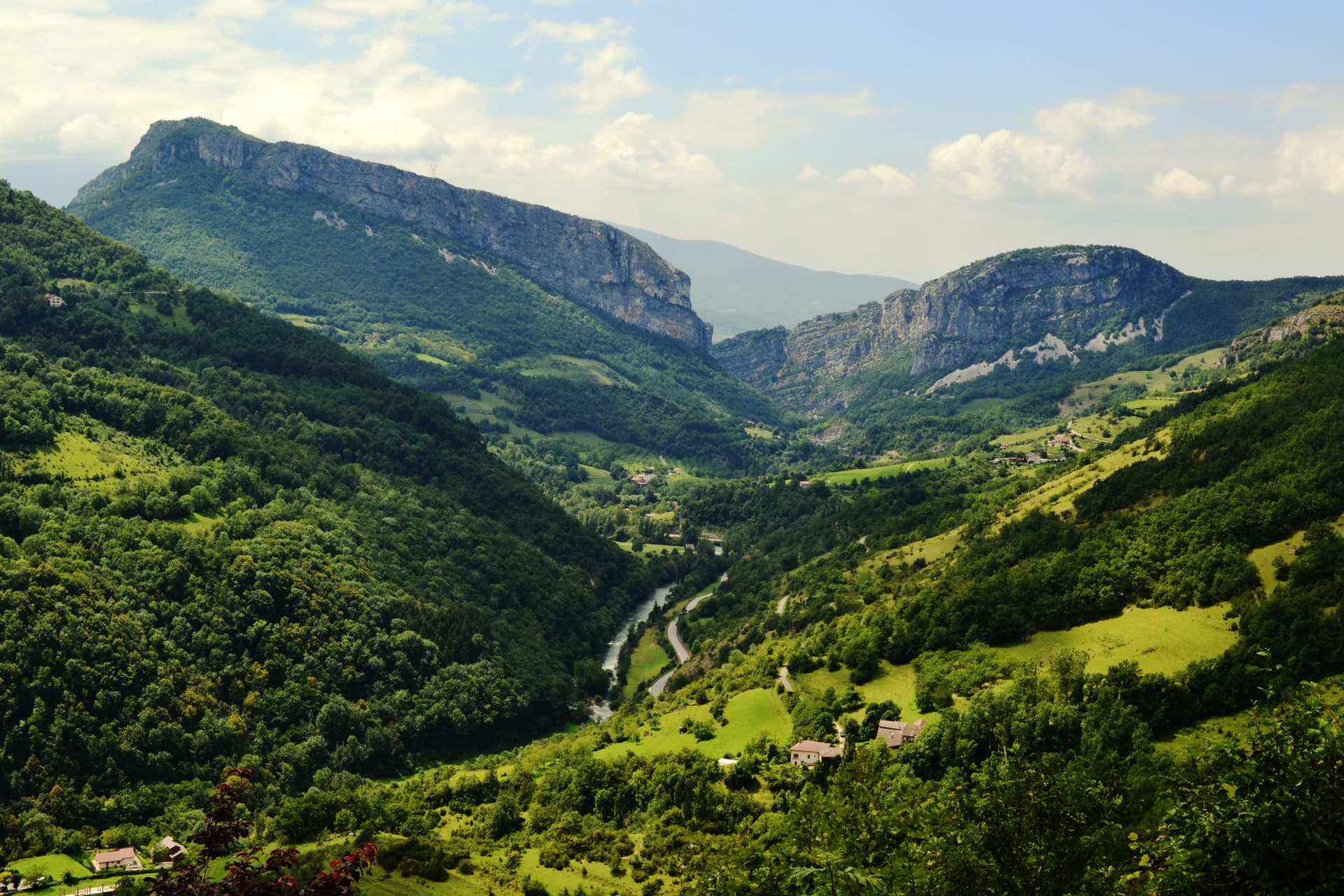
The massif is organized around several distinct areas. The High Plateaus form France's largest integral nature reserve in mainland territory: a limestone desert above 1,500 m, crossed by karst features and sinkholes. The Bourne Gorges and Nan Gorges cut the plateau with vertiginous cliffs. The villages of Villard-de-Lans and Autrans serve as bases for winter Nordic activities.
History and Context
In July 1944, the Vercors becomes a "free Republic": the resistance fighters proclaim a liberated territory before the Allied landing. The German army crushes the uprising in July-August 1944; the villages of Vassieux-en-Vercors and La Chapelle-en-Vercors are burned, hundreds of resistance fighters and civilians killed. The Resistance Memorial in Vassieux and the Resistance Museum in Grenoble document these events.
Highlights of Your Visit
The Vercors High Plateaus
Accessible on foot from the Col de la Chau or Col de Rousset, this desert plateau offers rare solitude. Wildlife is well preserved: griffon vultures reintroduced, chamois, ibex. No motorized vehicles are permitted.
Bourne Gorges
The road linking Pont-en-Royans to Villard-de-Lans hugs the Bourne at the bottom of a limestone canyon. The cliffs plunge directly onto the road in some places. It's also a renowned climbing area.
Vassieux-en-Vercors
Village rebuilt after its destruction in 1944, Vassieux houses the Vercors Resistance Memorial and a prehistoric flint-working site of world significance, classified UNESCO heritage (Neolithic tool-making workshop).
Pont-en-Royans
Medieval town with houses suspended above the Bourne, at the entrance to the gorges on the Drôme side. The Water Museum is housed in former troglodytic warehouses.
Cross-Country Skiing and Snowshoeing at Autrans-Méaudre
Autrans hosted events at the 1968 Grenoble Winter Olympics. The Nordic domain remains one of the most extensive in the Vercors, practicable from December to March depending on snow conditions.
Photography Tips
The raking morning light on the cliffs of the Bourne Gorges is particularly high-contrast. On the High Plateaus, summer skies after a storm reveal spectacular clouds over the karst terrain. For griffon vultures, late-morning thermal currents keep them in prolonged flight above the Royans cliffs.
Location and Access
The Vercors is flanked to the east by Grenoble, to the north by Voreppe, to the west by Romans-sur-Isère and Valence, to the south by Die. Main access routes pass through Col de Rousset (D518), Col de la Croix Perrin, and the Bourne Gorges road. By public transport, bus lines connect Grenoble to Villard-de-Lans and Autrans. PMR access to the high plateaus is impossible without a vehicle; valley floors are accessible.
Nearby
- Grenoble — gateway city to the Vercors, with its Resistance museum and Bastille accessible by cable car.
- Die — small town at the foot of the southern Vercors, known for its Clairette (sparkling AOC wine) and Roman ruins.
- Pont-en-Royans — houses suspended above the Bourne, entrance to the gorges on the Drôme side.
- Chartreuse Massif — neighboring Prealp massif northeast of Grenoble, with the Grande Chartreuse monastery.
- Vassieux-en-Vercors — Resistance memorial and UNESCO-classified Neolithic site.
Frequently asked questions
June to September for hiking on the high plateaus. December to March for cross-country skiing in Autrans or Villard-de-Lans. Spring (May) is ideal for the gorges, before summer crowds.
Yes: high-ankle hiking boots, warm and waterproof clothing even in summer, sufficient water (few water sources on the limestone plateau). An IGN map of the area is recommended.
Yes. Grenoble can be visited in half a day (Bastille, old town, museum). The rest of the weekend allows for a hike through the gorges or on the plateau from Villard-de-Lans, approximately 30 km away.
The gorges road (D531) is open to traffic but narrow and winding. Temporary closures have occurred after rockfalls; check the road status with Isère authorities before departing.
Griffon vultures, reintroduced since the 1990s, soar mainly above the Royans cliffs and High Plateaus. Observers often position themselves near Col de la Bataille or Royans viewpoints in late morning.
Yes, for two distinct reasons: the Resistance Memorial traces the 1944 events with archives and testimonies; the Neolithic flint-working site, UNESCO-classified, is one of the rare prehistoric workshops visible in Europe.
Photos
Discover Vercors Massif with our itineraries
All our tours →
Want to discover this destination?
Our local advisors design your tailor-made trip.