West Coast and Gulf of Porto
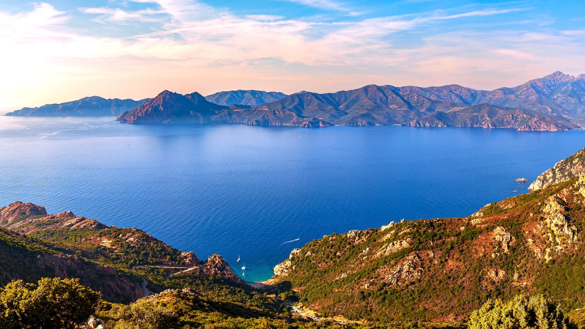
Red granite of the Piana Coves, Scandola marine reserve accessible by sea and perched villages above the Gulf of Porto, within a tight boundary between coast and mountain.
The west coast between Porto and Piana concentrates a particular geology: red granite sculpted by erosion into needles, taffoni and arches, descending directly into the Mediterranean. The Piana Coves, listed as a UNESCO World Heritage site since 1983 alongside the Scandola nature reserve and the Gulf of Girolata, form a protected ensemble of approximately 120 km². The D81 road, carved into the rock face over 6 kilometres between Porto and Piana, is narrow: delicate crossing manoeuvres, and we recommend driving it early morning or late afternoon, when light turns the granite a deep orange.
The village of Porto, at the mouth of its namesake river, serves as the logistical base. Its 16th-century Genoese tower marks the entrance to a gulf opening westward, making it one of the rare spots in Corsica where you can watch the sun set over the sea. Higher up, clinging to the mountain, the villages of Ota and Évisa overlook the Spelunca Gorges, a ravine carved by torrents descending from the Vergio Pass. Évisa, at 850 metres elevation, is known for its chestnut trees and the chestnut festival in November. At 1,477 metres, the Vergio Pass marks the passage toward the mountainous centre and the GR20.
Scandola can only be visited by sea. The reserve, created in 1975, protects red rhyolite volcanic cliffs where osprey, crested cormorants and Audouin's gulls nest. Outings depart from Porto, Cargèse or Calvi, lasting 3 to 5 hours with a stop in Girolata. This hamlet of about thirty year-round residents, with no road access, can only be reached by boat or the postman's trail, approximately 1 hour 30 minutes walk from the Croix Pass. In winter, Girolata empties almost entirely.
South of the gulf, Cargèse has a singular history: founded in the 17th century by Greek families from the Mani region in the Peloponnese, fleeing the Ottomans. Two churches face each other on the promontory, one Catholic of Latin rite, the other Catholic of Greek rite, still active. Greek prayers can still be heard during services. Further down towards Ajaccio, the coast opens onto the Gulf of Sagone and its more accessible sandy beaches, notably Sagone and Liamone.
The hinterland cuisine rests on chestnuts (Pulenda flour, fritters), wild boar transformed into figatellu and coppa around Évisa, and stream trout. The beaches of Bussaglia, Caspiu and Arone offer swimming in clear water, with a seabed that drops quickly. For hikers, the Capu Rossu trail leads in 2 hours to the Turghiu Genoese tower, perched 331 metres above the sea, with views north across the entire gulf.
This region remains less frequented than the Balagne or the South, except for the Piana-Porto section in July-August where traffic can become problematic. We envision it as terrain that combines sea, moderate mountain hiking and hilltop villages within a tight perimeter: less than 50 kilometres separate Porto's beaches from the Vergio Pass.
To discover
Piana Coves in late afternoon. Drive the D81 between 5pm and 7pm in summer, when the red granite glows. Stop at Château Fort and Tête de Chien for short walks of 30 minutes through the taffoni.
Scandola and Girolata by sea. 4-hour boat trip departing from Porto, passing the base of the rhyolite cliffs and a one-hour stop in Girolata, a hamlet with no road access reachable only by boat or trail.
Capu Rossu and its Genoese tower. 4-hour round-trip hike on the Piana peninsula, stony and exposed terrain, arriving at the Turghiu tower perched on a spur 331 metres above the open sea.
The two churches of Cargèse. Latin church and Greek church facing each other on the promontory. Community of Maniote origin settled here since 1676, maintaining the Byzantine rite during Easter celebrations.
Spelunca Gorges from Ota. Paved mule trail connecting Ota to Évisa in 3 hours, back-arched Genoese bridges above clear water pools, beneath a vault of Corsican pine.
When to go
The best period extends from mid-May to end of June, then from mid-September to mid-October. The sea reaches 20 to 22°C in June and remains swimmable until October (around 21°C). Temperatures in Porto range between 25 and 30°C during the day in this season, compared to 15 to 18°C at the heights of Évisa and the Vergio Pass. July and August bring heavy traffic on the D81 and Piana car parks, with temperatures potentially exceeding 33°C by the sea. Boat trips to Scandola are then saturated and we advise booking at least one week in advance.
In winter, from December to March, the coast remains mild (10 to 14°C during the day) but many restaurants and hotels in Porto close from November to Easter. The mountain above Évisa receives snow, the Vergio Pass may close. April and early May see the Spelunca torrents at full flow, pleasant for hiking but with some tricky ford passages.
Practical advice
We recommend a minimum of 3 full days to cover the region without rushing: one day at sea (Scandola, Girolata), one day in the coves and beaches, one day in the hinterland (Spelunca, Évisa, possibly Capu Rossu). Access is from Ajaccio airport (1 hour 30 minutes drive) or Calvi (1 hour 45 minutes via the coast). The D81 between Calvi and Porto is spectacular but slow, expect 2 hours 30 minutes actual time with stops.
The region combines naturally with the Balagne to the north (continuity via the coastal road), the Mountainous Centre to the east via the Vergio Pass to reach Corte, or the South via Ajaccio. Accommodation is dominated by small family hotels and guesthouses, few upmarket establishments: this is terrain for travellers who accept simple comfort in exchange for a raw setting. Suits hikers well, boat enthusiasts and couples seeking hilltop villages. For families with young children, we recommend Porto or Sagone instead, the interior roads being winding.